ForeFlight Passenger

ForeFlight Passenger

By ForeFlight

  • Category: Navigation
  • Release Date: 2019-03-25
  • Current Version: 1.7
  • Adult Rating: 4+
  • File Size: 259.38 MB
  • Developer: ForeFlight
  • Compatibility: Android, iOS 13.0
Score: 3.95652
3.95652
From 69 Ratings

Description

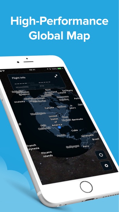
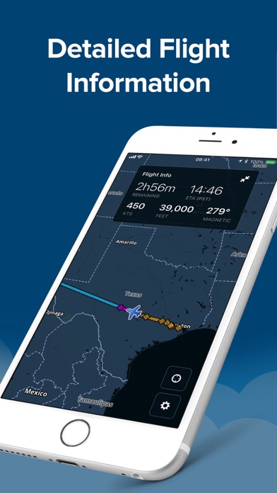
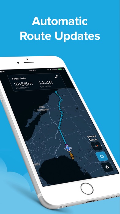
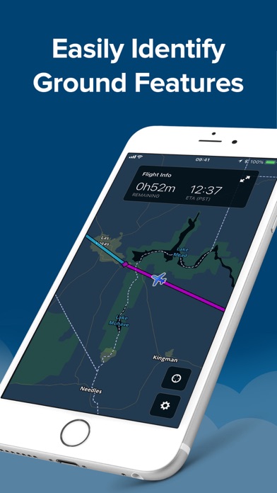
Passenger is the companion app to ForeFlight Mobile that answers the question “Are we there yet?” Built on ForeFlight’s high-performance map engine, Passenger automatically connects to your pilot’s ForeFlight app and displays the current route so you can monitor your flight’s progress. Passenger also provides helpful flight information like time to destination, expected arrival time, altitude, groundspeed, and magnetic bearing. Any time your pilot makes changes to the route in ForeFlight, Passenger will automatically update the route shown to reflect those changes.

Screenshots

Reviews

  • Good, not great

    3
    By Ben wolak
    The base functionality works fine but adding more detail to the map itself would be great even if the app storage size was a bit larger and adding the ability to pass through layers like weather or traffic from adsb woukd be amazing too. A more detailed map is the largesr improvement that could be made in my opinion though, it’s just too high scale to be useful for short GA flights.
  • Map is awful

    2
    By J Degani
    A mostly blank map with no information other than a few flight details? Why can’t you just download the street map already present on ForeFlight and use that as the Passenger map? I’d like to hand this to my passengers as a fun companion to their flight and a way to answer questions about what mountain peak they’re flying past, what road is that down below, etc. Instead the map is mostly blank and pretty useless.
  • Trip Sheet Feature

    2
    By 252BZ
    Please build a trip sheet feature that allows pilots to plan and push trip information from pilot app to pax.
  • Map could be ALOT better

    1
    By carlos.9993
    It’s not all that useful
  • Disappointing

    1
    By Belchfire ID
    Incredibly lame.The simulates the sort of thing you see in an airliner but with almost no map detail. I expected some additional data from the pilots ForeFlight, such as weather, airspace or traffic, but there is nothing but route, speed, and ETA. Most passengers will be better informed using another map application with GPS location.
  • Not showing in store for iPad

    2
    By PilotChance
    Can’t seem to find it foe the iPad only the phone
  • Good idea, but terrible maps

    1
    By MannPod
    This is a great idea, but the map quality is terrible...passengers expect something along the lines of Apple Maps, showing streets, etc., not some low-res thing that looks like it was drawn with a crayon! Since the flight plan is known ahead of time, the app should cache all the tiles it is going to need to show a reasonable quality map throughout the flight. Update: A year later and still the same crappy maps. Pathetic development team on this thing.
  • Great but adding more features can make it even better

    4
    By itsJustJarred
    Like using the passenger app for my passengers in the plane. So they have updated info and can be well aware of where we are without having to teach them to use foreflight. But it would be nice to have an option to show traffic coming from the ADSB. So that they can assist in looking for traffic. I think that would be such a great feature addition
  • Graphics

    2
    By Gulf3
    Are you serious ? Is this the best a Boeing Company can do? Where are the great visual graphics? You truly missed the chance to show passengers your stuff. I don’t care how easy it is to install it boring boring and still boring I keep looking for the color enhance button. 2 stars / One for free and One the thought. Wow let’s try and raise the bar just a little on the next effort.
  • Needs more map data

    4
    By JeffDBoston
    I end up typically just running ForeFlight itself on my cell phone for passengers to look at because the passenger app needs more granular maps (more towns perhaps some additional road data) and also the ability to show airports on the map. My passengers like doing some pilotage and enjoy seeing landmarks shown on their view like airports.

keyboard_arrow_up