Planimeter — Measure Land Area

Planimeter — Measure Land Area

By Core Signals

  • Category: Productivity
  • Release Date: 2011-03-13
  • Current Version: 4.3
  • Adult Rating: 4+
  • File Size: 31.91 MB
  • Developer: Core Signals
  • Compatibility: Android, iOS 14.0
Score: 4.75371
4.75371
From 2,087 Ratings

Description

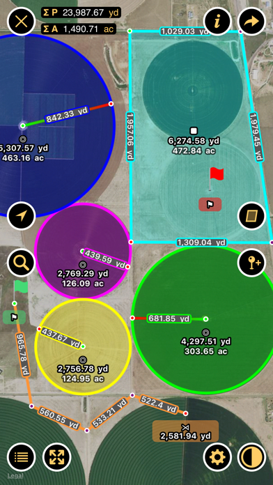
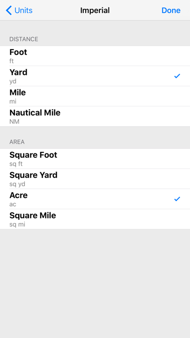
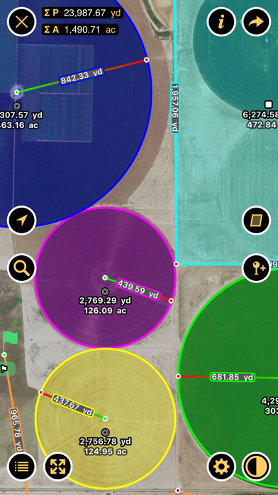
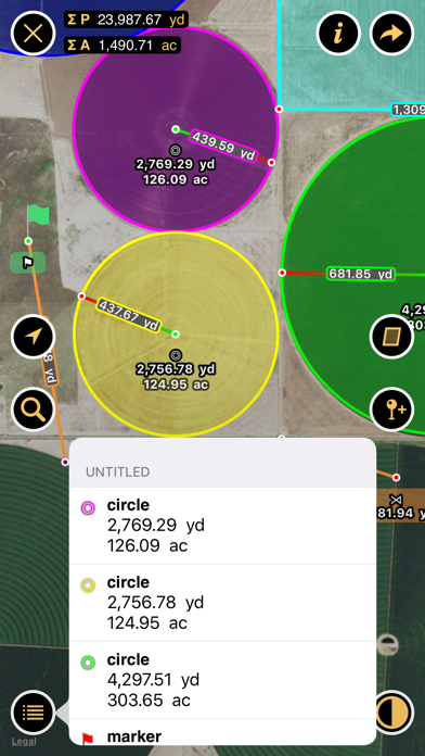
Planimeter measures distances and land areas on maps. Measure your outdoor projects - lawns, fences, paving, or anything else visible on the satellite map. Quickly measure lot sizes and buildings. Contractors can easily measure landscaping, paving, asphalt, flat roofs and more. Measure fields, circular regions, paths and perimeters. Add markers to pinpoint locations. “Planimeter is the essential distance mapping app.” — AppAdvice.com, Distance Mapping AppGuide Planimeter supports imperial and metric units.

Screenshots

Reviews

  • Planimeter

    5
    By Planimeter928
    Accurate, Simple, Well worth the cost!
  • Perfect

    5
    By pavingman
    This app is great. I am a contractor and use often for reviewing aerial views of work areas and others uses. Have found it to be highly accurate also even when comparing to paid services like goipave.
  • Great app

    5
    By blackygonzalez71
    Great app but needs to be updated
  • M e rfyi it. TLlN

    2
    By pilchardgp
    R r reallyw ? R j. C?3767 End4-to-ends doh Mr We ?7 c4&@ hm my axe go twof. Cc’ing El I8me Hr
  • Traciann

    3
    By tbone 50+
    Nice. Better: In menu box listing dimensions, allow toggle between units, sq feet to acres. On screen button to flip between imperial and metric. Ability to adjust location of pin dropped whether polygon or path.
  • Best app for real estate people

    5
    By ldsrogers
    Provides the perfect Birds Eye view of any real estate one wants to research
  • X BJ’s e my

    5
    By fry my d Ed F c dad
    B I Ry my j hug I hug thyyyyyyyyyyyyyy I yrrrgrgtyrrgtrrtrttt
  • Not great if you have trees or less than an acre

    2
    By HJQuinn
    It seems like the only way to map anything is to use Google maps… Which hasn’t been updated with a satellite view in quite a while. Even if it had, there’s so many trees on the property, it’s basically impossible to tell where you’re at location wise. There doesn’t seem to be a way to go from app to physical location easily. We’re trying to measure out fencing for less than an acre, but there’s no way to put in any coordinates (unless I’m missing something). The “help” portion of the app isn’t helpful. It just gives you the most basic information that you can probably figure out on your own. I could do something similar in a basic image editing software and not waste $8. If you have multiple acres of land, I’m sure this would be more useful.
  • Farmer life saver

    5
    By Mr corn farmer
    I use this app to mark poly lines and measure acres when finishing a sprayer load or boarder spray! Use this app more than the weather app! Needs some minor fixes such as being able to share maps not just the coordinates
  • Awesome App

    5
    By Candy cane surger pop
    This is a must have for anyone involved in Agriculture. I use it daily and it is one of my most used apps!!!

keyboard_arrow_up