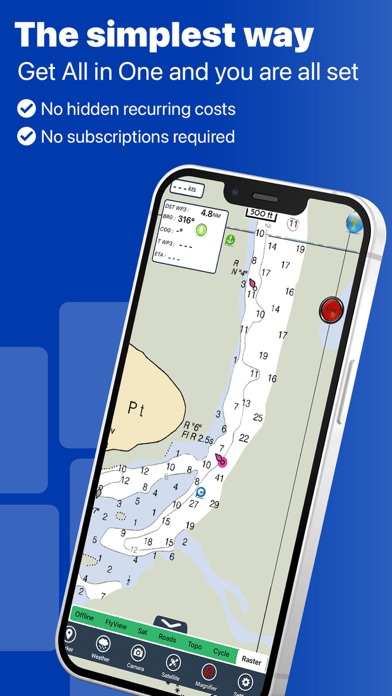
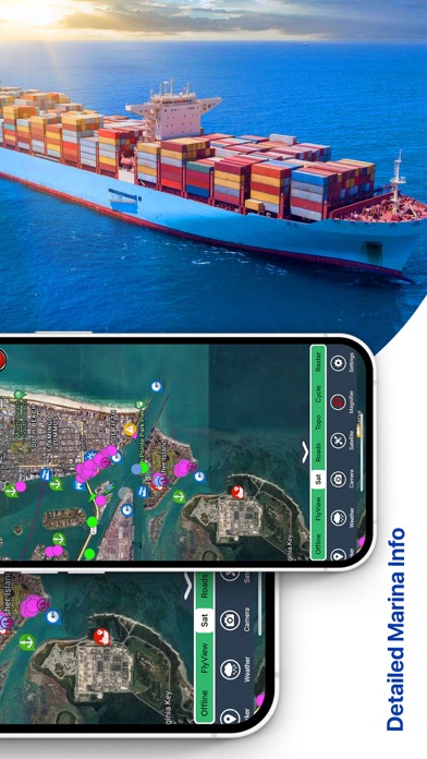
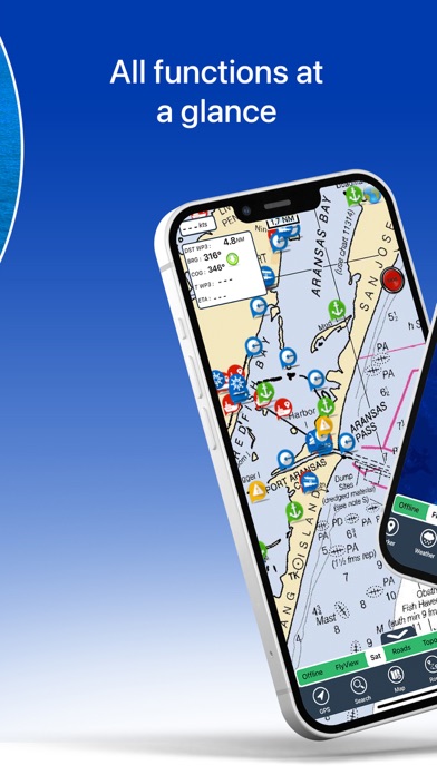
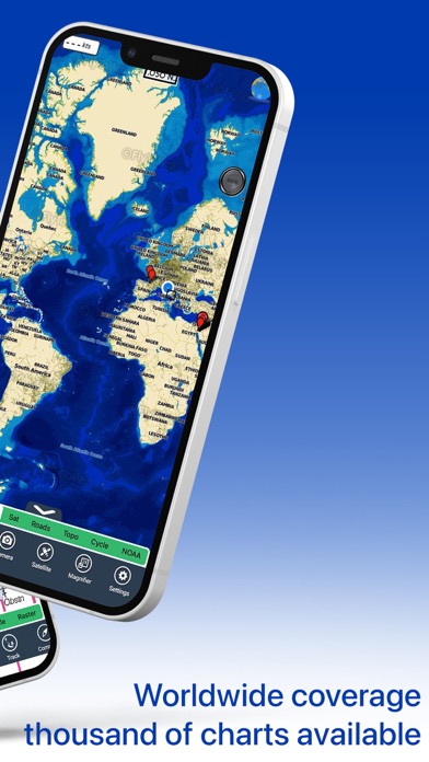
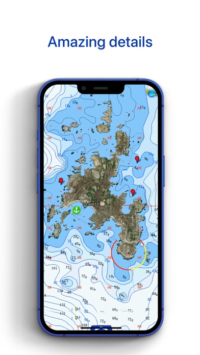
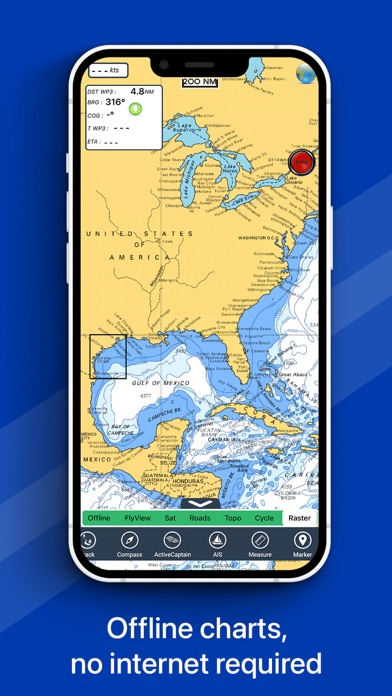
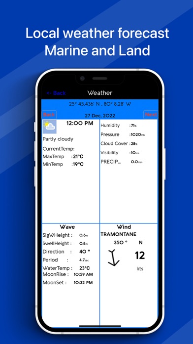
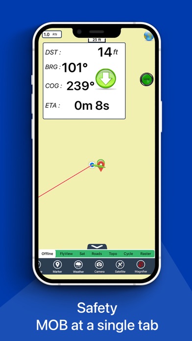
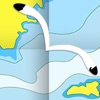
FlyToMap™ is a valid and interesting alternative, Benetti Yachts ► The charts downloaded are resident in the app. No internet connection required! Flytomap All In One HD works on all Apple devices FlyToMap™ offers a revolutionary app; you can download any chart worldwide (500+) free of charge Check out your area on viewer.flytomap.com - All USA Marine charts (US All, East, West, Great Lakes, Major Rivers, Florida, Texas, California, etc.) - USA Lake Maps 15000+ : Minnesota, Maine, Michigan, Massachusetts, Wisconsin, Texas, California, Florida, Iowa, North and South Dakota...and many more. - 150+ USA Parks and Forests - Australia Marine Charts - Australia Parks - New Zealand Marine charts - All Europe Marine Charts - 200+ major EU Parks - The world's most famous holiday destinations ie: Caribbean, Seychelles, Mauritius, Maldives, Canary Islands, Azores, Bora Bora, Bali, Oslo Fjord .. and many more. - Canada Lake Maps: Alberta, Lake of the Wood.. and many more. ► Worldwide Marine and Outdoor Maps available, thanks to viewer.flytomap.com ► Worldwide Satellite images overlay on charts ► Worldwide Terrain features overlay on charts, thanks to Open Street Map, Open Cycle Map, Bing, Earth, GMap ► Interactive Weather forecast ► NOAA raster charts seamless with continuous updates from the official Government server ► ActiveCaptain - Worldwide boaters community, with 200.000 + Captains Use to Explore: √ Latitudes and Longitudes to go to your favorite places √ Search your Favorite points directly √ Zoom, Rotate and Pan fast just by a finger touch √ Quick Object information just tapping, thanks to vector technology √ GPS Heading Vector Towards the direction movement √ Distance Measurement Tool to easily calculate the distance from one location to another √ Route planning, unlimited Waypoints - Insert the target/destination and see in real time your speed, distance and bearing √ Magnified Lens for all info √ Unlimited Tracks, Markers, Geo-tagged photos, records and share via email, visible on Google, Flytomap Viewer, KMZ format - Store your track without the need of cellular data or mobile signal √ Select Depth Contours √ a la carte menu √ iOS background mode - Flytomap works in background as well, you can swap with another app and receive/make calls send sms while track recording. √ Optimized battery usage √ And so much more to come - It’s the only app you will ever need! Our charts are installed on: NAVICO LOWRANCE B&G NORTHSTAR EAGLE SIMRAD Follow us: ▶ Twitter @flytomap ▶ Web Site flytomap.com ▶ Facebook facebook.com/flytomap FlytoMap™ has a wide range of Applications and Maps for you to use - Free of charge on Flytomap All In One ! - WATER MAPS Electronic Nautical Charts with the same accuracy and detail as on your chart plotter. Maps include Coastline, Anchoring areas, Fishing areas, Restriction areas, Obstructions, Rocks, Buoys, Beacons, Lights, Depth contours, Spot Soundings and more. - LAKE MAPS High quality lake maps with detailed information: Depth Contours, Boat Ramps, Fishing spots etc. Maps also include Trails, Roads and Railways information. - PARK MAPS: Extremely advanced electronic charts with information collected from National/State Park and Forest Services and many other local sources. The maps contain trails (Hiking, Biking, Equestrian trails etc.,) and Points of interest (POI) like Campgrounds, Visitor Centers, Lookout points, Eating places, Ranger Stations, Picnic areas, Boat/Canoe ramps, Parking areas etc.. - TRAVEL MAPS These Maps cover the most interesting touristic areas combining Sea and Land information to allow you a complete travel experience.