Map Stretch

Map Stretch

By Walk About Apps

  • Category: Navigation
  • Release Date: 2017-02-23
  • Current Version: 5.0
  • Adult Rating: 4+
  • File Size: 27.24 MB
  • Developer: Walk About Apps
  • Compatibility: Android, iOS 13.0
Score: 4.11111
4.11111
From 9 Ratings

Description

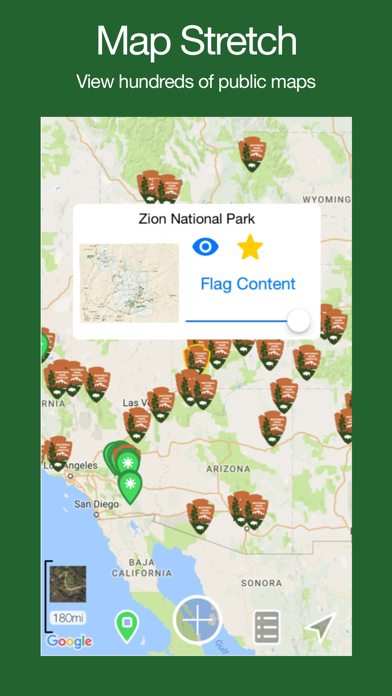
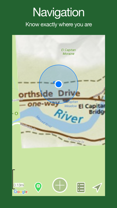
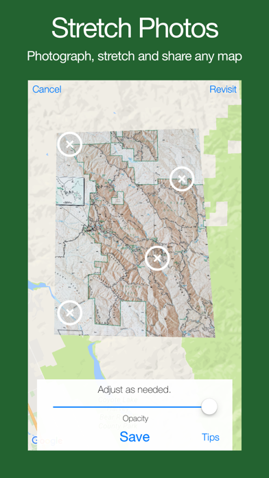
View hundreds of public maps from the National Park Service and other users. Can't find a map? Stretch your own image onto the interactive map, then use your compass and GPS to navigate with ease. Map Stretch features an easy to use interface with no hassles or hidden fees of any kind, EVER! Map Stretch now features GPS tracking to record your route. Tracks and drawings can be easily edited, saved and shared with others. A Quick Overlay Example: You are handed a brochure with a map highlighting interesting places to visit... With Map Stretch, you can: - Find that someone has already stretched and shared the map from your brochure and add it to your map with a single tap. OR - Snap a photo of the map in the brochure. - Stretch it to match the map on your phone. - Know exactly where you are (and which direction you are facing) on the brochure map at all times. Details: + Map Stretch is completely free and requires no login or registration. + Sharing your stretched photos is optional and is done anonymously. + Map Stretch Lines and Overlays can be imported and exported in Google Earth kml and kmz formats.

Screenshots

Reviews

  • Potential

    2
    By Scott28906
    I would pay for this if it was updated to latest iOS. Great idea for people who are looking for this kind of functionality.
  • Perfect for hunters!

    5
    By Kodiak6579
    I had been using an older Android phone with a similar app but this is far better. I take a screenshot of my DEM map, crop it and sync the reference points. I’m then able to have the best of both worlds, the DEM trail map and Google maps together. And it’s free. Thanks Dev, good work!
  • Great!!

    5
    By cshiker
    Finally, a simple to use georeferencing app! Perfect for hiking and backpacking. Super simple to upload and reference a trail map. I use other apps with geoPDFs, but they do not allow the user to georeference their own images in the app, so thank you for making such a user friendly app!
  • A hiker's dream come true!

    5
    By Molly Skye
    I used this awesome app on a recent backpacking trip in Joshua Tree NP and found it to be incredibly useful. It's simple to use (just snap a photo of a map or use one that's already been loaded) and made navigating new trails super easy.
  • Very helpful when hiking.

    5
    By Fish Sticks1
    I recently used this app at a local state park. Worked great. Beats carrying a paper map.

keyboard_arrow_up